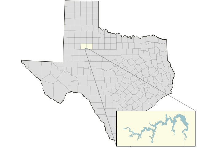
Lake Alan Henry: 71.9% full as of 2026-09-13
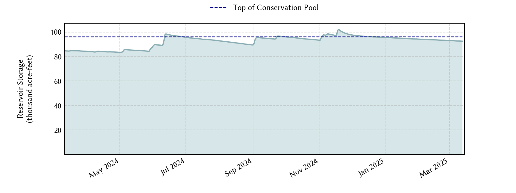
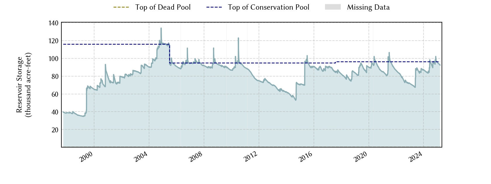
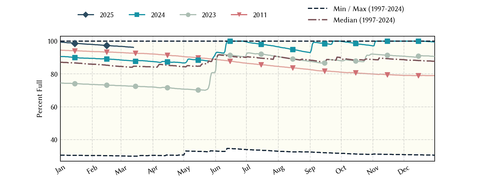
Historical Data
| Date | Percent Full |
Mean Water Level (ft) |
Reservoir Storage (acre-ft) |
Conservation Storage (acre-ft) |
Conservation Capacity (acre-ft) |
Surface Area (acres) |
|
|---|---|---|---|---|---|---|---|
| Today | 2026-09-13 | 71.9 | 2,208.91 | 69,169 | 69,169 | 96,207 | 2,140 |
| Yesterday | 2026-09-12 | 72.0 | 2,208.95 | 69,255 | 69,255 | 96,207 | 2,142 |
| 2 days ago | 2026-09-11 | 72.1 | 2,208.98 | 69,319 | 69,319 | 96,207 | 2,143 |
| 1 week ago | 2026-09-06 | 72.3 | 2,209.10 | 69,577 | 69,577 | 96,207 | 2,148 |
| 1 month ago | 2026-08-13 | 74.7 | 2,210.17 | 71,900 | 71,900 | 96,207 | 2,195 |
| 3 months ago | 2026-06-13 | 79.3 | 2,212.11 | 76,253 | 76,253 | 96,207 | 2,292 |
| 6 months ago | 2026-03-13 | 83.6 | 2,213.88 | 80,390 | 80,390 | 96,207 | 2,380 |
| 1 year ago | 2025-09-13 | 93.3 | 2,217.62 | 89,742 | 89,742 | 96,207 | 2,632 |
*
Percent Full is based on Conservation Storage and Conservation Capacity and doesn't account for storage in flood pool.
**
Values above, including today's are averaged conditions. For near real-time instantaneous water level, see table below or the interactive map viewer.
Most Recent Instantaneous Water Level
| Date/time |
Water Level (ft) |
Conservation Pool Elevation (ft) |
Height Above Conservation Pool (ft) |
|
|---|---|---|---|---|
| Most recent | 2026-09-13 18:30 | 2,208.89 | 2,220.00 | -11.11 |
| 1 hour prior | 2026-09-13 17:30 | 2,208.89 | 2,220.00 | -11.11 |
| 2 hours prior | 2026-09-13 16:30 | 2,208.89 | 2,220.00 | -11.11 |
| 6 hours prior | 2026-09-13 12:30 | 2,208.91 | 2,220.00 | -11.09 |
| 12 hours prior | 2026-09-13 06:30 | 2,208.91 | 2,220.00 | -11.09 |
| 24 hours prior | 2026-09-12 18:30 | 2,208.93 | 2,220.00 | -11.07 |
| 48 hours prior | 2026-09-11 18:30 | 2,208.98 | 2,220.00 | -11.02 |
*
Data is provisional and subject to revision.
Additional Information
| Impoundment date | 1994-01-01 |
| Vertical datum | NGVD29 |
| Service spillway crest elevation | 2,220.00 ft above NGVD29 |
| Emergency spillway crest elevation | 2,240.00 ft above NGVD29 |
| Maximum design elevation | 2,245.00 ft above NGVD29 |
| Top of dam elevation | 2,263.00 ft above NGVD29 |
| Conservation pool elevation | 2,220.00 ft above NGVD29 |
| Data download (CSV) | period of record, last one year, last 30 days |
Elevation-Area-Capacity Curves
1993-10-01 (source: USGS)
2005-07-01 (source: TWDB)
: GIS Data
2017-08-01 (source: TWDB)
: GIS Data
|
|
| Data Source | USGS:08079700 |
| USGS Monitoring Location | USGS:08079700 |
Lake Location