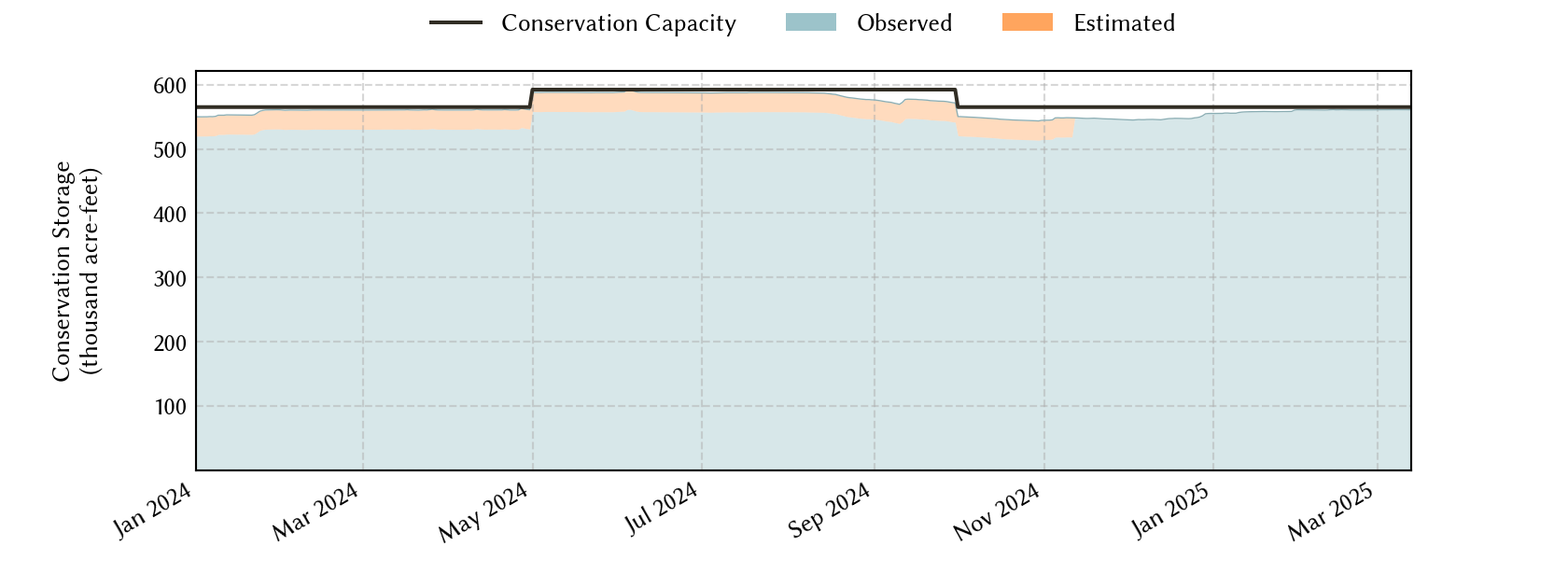
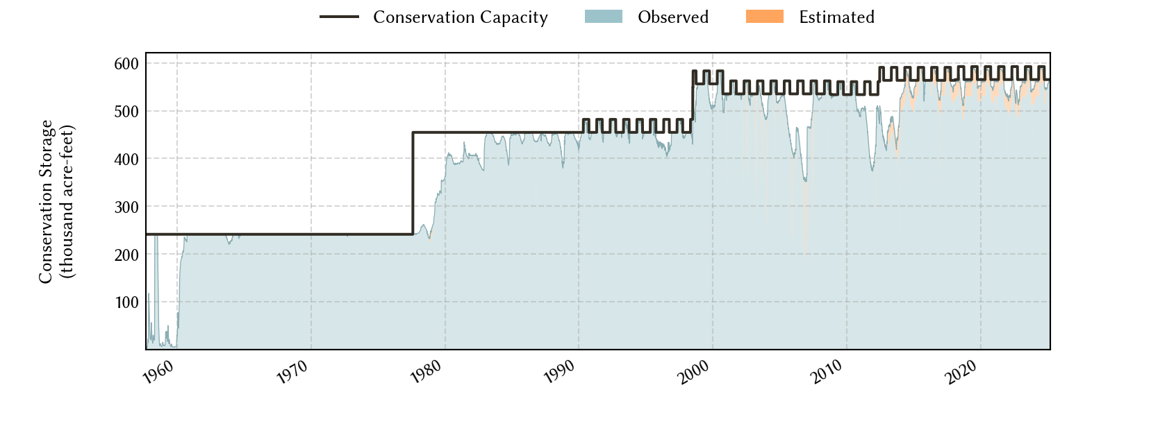
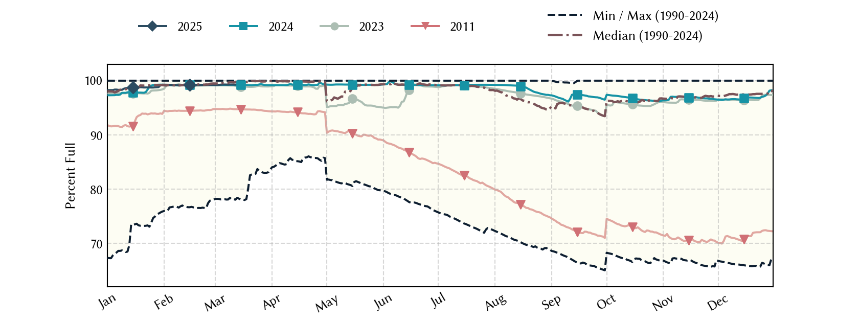
Cypress River Basin Reservoirs: Monitored Water Supply Reservoirs are 93.7% full on 2026-07-30
Historical Data
| Date | Percent Full |
Reservoir Storage (acre-ft) |
Conservation Storage (acre-ft) |
Conservation Capacity (acre-ft) |
|
|---|---|---|---|---|---|
| Today | 2026-07-30 | 93.7 | 667,189 | 554,818 | 592,377 |
| Yesterday | 2026-07-29 | 93.8 | 668,303 | 555,449 | 592,377 |
| 2 days ago | 2026-07-28 | 93.9 | 669,416 | 556,080 | 592,377 |
| 1 week ago | 2026-07-23 | 94.4 | 675,200 | 559,480 | 592,377 |
| 1 month ago | 2026-06-30 | 94.8 | 691,273 | 561,798 | 592,377 |
| 3 months ago | 2026-04-30 | 97.3 | 672,025 | 550,019 | 565,174 |
| 6 months ago | 2026-01-30 | 96.1 | 664,474 | 543,064 | 565,174 |
| 1 year ago | 2025-07-30 | 98.4 | 700,273 | 583,163 | 592,377 |
*
Percent Full is based on Conservation Storage and Conservation Capacity and doesn't account for storage in flood pool.
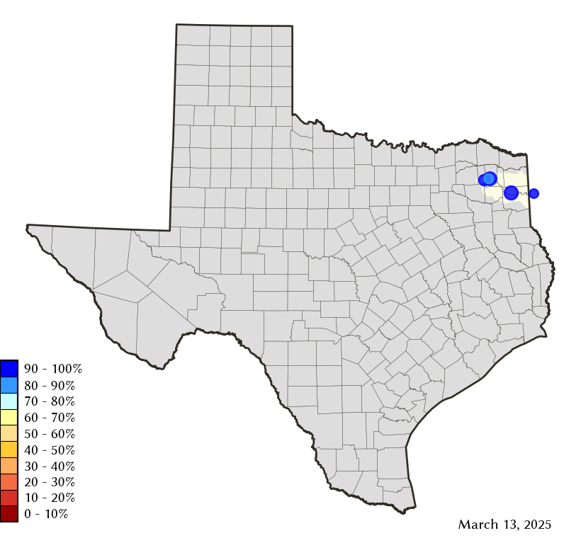
Area Map
Reservoir Storage
| Reservoir | Type | Percent Full |
Water Level (ft) |
Height Above Conservation Pool (ft) |
Reservoir Storage (acre-ft) |
Conservation Storage (acre-ft) |
Conservation Capacity (acre-ft) |
Surface Area (acres) |
|---|---|---|---|---|---|---|---|---|
| Bob Sandlin |

|
94.9 | 336.38 | -1.12 | 193,315 | 182,584 | 192,417 | 8,669 |
| Caddo 1 |
|
100.0 | 168.64 | 0.14 | 131,538 | 29,898 | 29,898 | 27,045 |
| Cypress Springs |
|
96.2 | 377.21 | -0.79 | 64,225 | 64,225 | 66,756 | 3,175 |
| Lake O' the Pines |

|
93.3 | 229.01 | -0.99 | 250,443 | 250,443 | 268,566 | - n.a. - |
| Monticello |
|
79.6 | 336.22 | -3.78 | 27,668 | 27,668 | 34,740 | 1,659 |
footnotes
1
Caddo Lake straddles the border of Texas and Louisiana, Texas has rights to 50% of Lake Caddo's total conservation capacity. Percent full, conservation storage and conservation capacity are based on the Texas share.