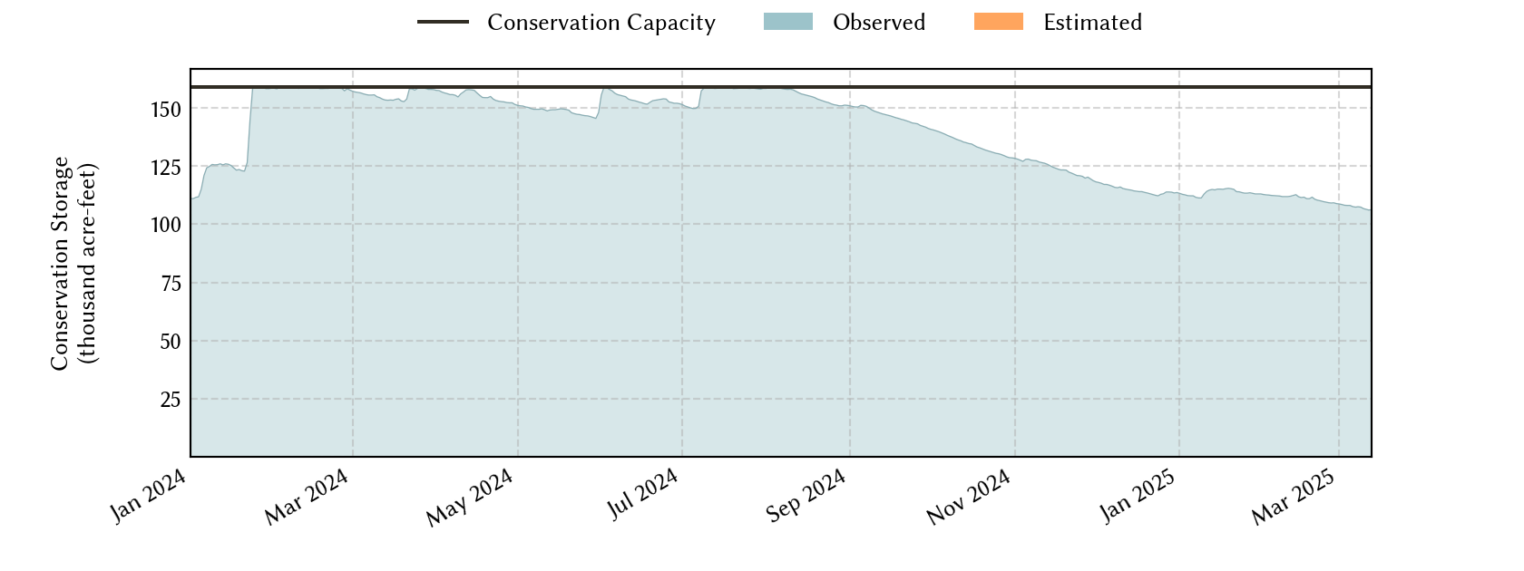
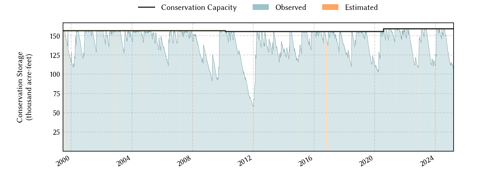
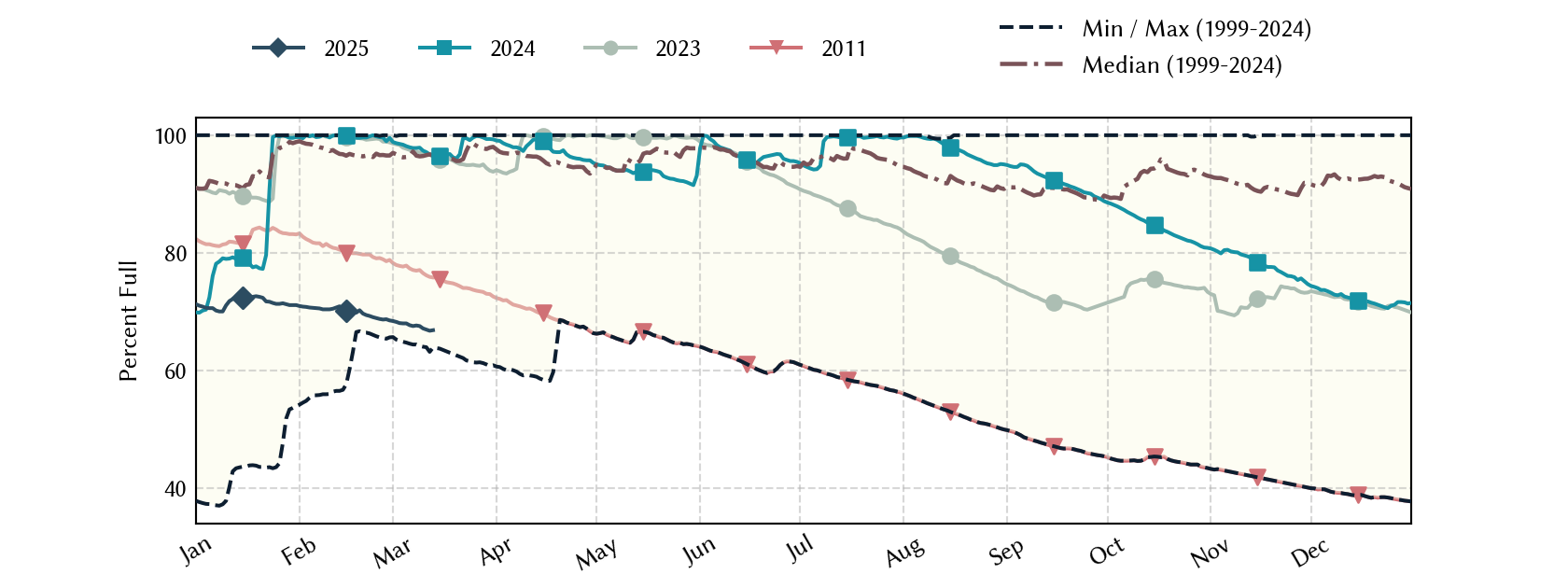
Lavaca Planning Region Reservoirs: Monitored Water Supply Reservoirs are 98.0% full on 2026-07-30
Historical Data
| Date | Percent Full |
Reservoir Storage (acre-ft) |
Conservation Storage (acre-ft) |
Conservation Capacity (acre-ft) |
|
|---|---|---|---|---|---|
| Today | 2026-07-30 | 98.0 | 161,024 | 155,811 | 158,975 |
| Yesterday | 2026-07-29 | 98.2 | 161,329 | 156,116 | 158,975 |
| 2 days ago | 2026-07-28 | 98.6 | 161,938 | 156,725 | 158,975 |
| 1 week ago | 2026-07-23 | 100.0 | 164,793 | 158,975 | 158,975 |
| 1 month ago | 2026-06-30 | 99.3 | 163,060 | 157,847 | 158,975 |
| 3 months ago | 2026-04-30 | 64.8 | 108,223 | 103,010 | 158,975 |
| 6 months ago | 2026-01-30 | 60.3 | 101,029 | 95,816 | 158,975 |
| 1 year ago | 2025-07-30 | 96.1 | 157,999 | 152,786 | 158,975 |
*
Percent Full is based on Conservation Storage and Conservation Capacity and doesn't account for storage in flood pool.
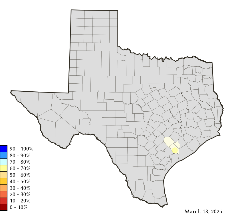
Area Map
Reservoir Storage
| Reservoir | Type | Percent Full |
Water Level (ft) |
Height Above Conservation Pool (ft) |
Reservoir Storage (acre-ft) |
Conservation Storage (acre-ft) |
Conservation Capacity (acre-ft) |
Surface Area (acres) |
|---|---|---|---|---|---|---|---|---|
| Texana |

|
98.0 | 43.69 | -0.31 | 161,024 | 155,811 | 158,975 | 10,140 |