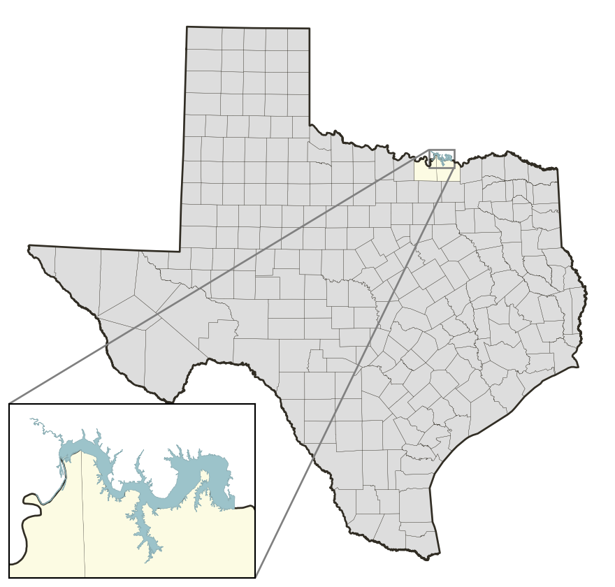
Lake Texoma: 96.2% full as of 2026-09-13
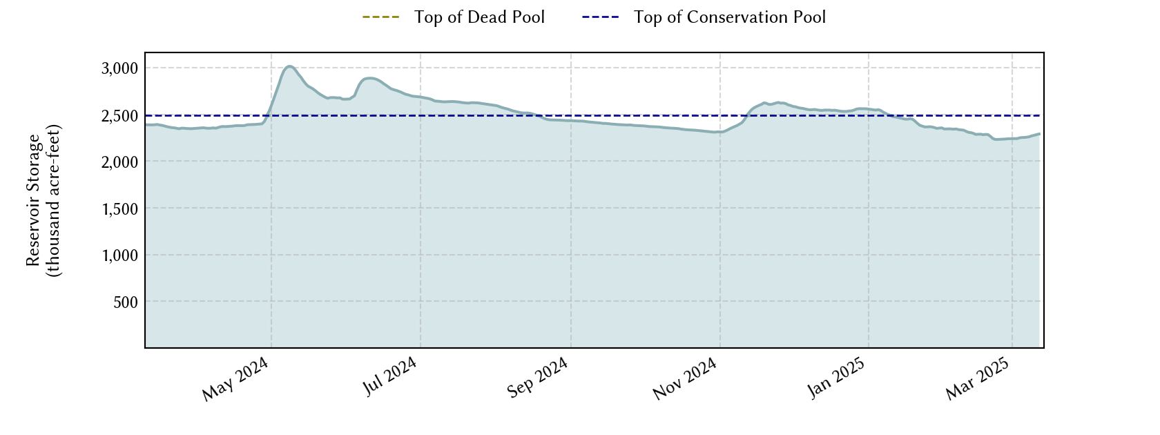
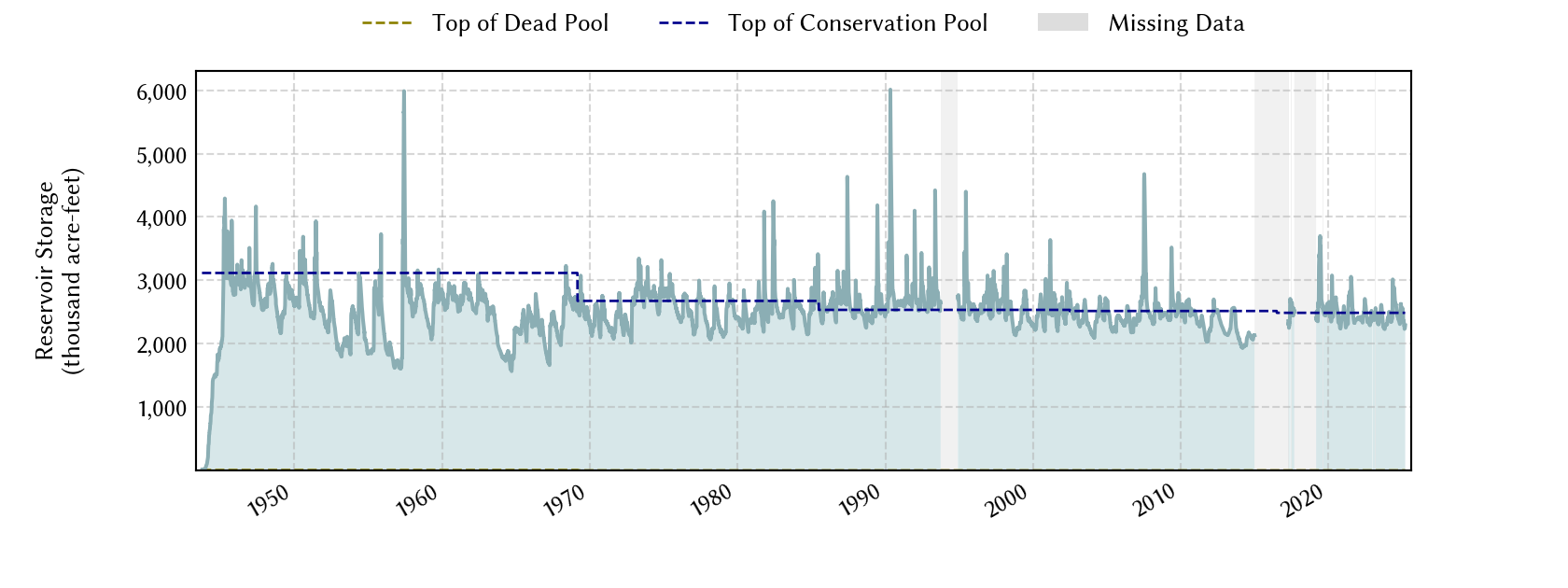
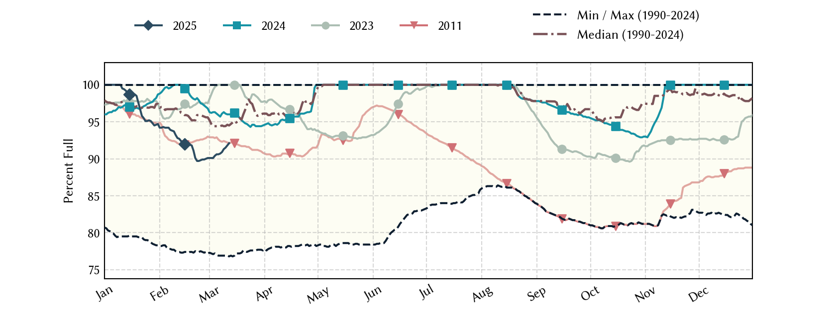
Lake Texoma straddles the border of Texas and Oklahoma, Texas has rights to 50% of Lake Texoma's total conservation capacity. Percent full, conservation storage and conservation capacity are based on the Texas share.
Historical Data
| Date | Percent Full |
Mean Water Level (ft) |
Reservoir Storage (acre-ft) |
Conservation Storage (acre-ft) |
Conservation Capacity (acre-ft) |
Surface Area (acres) |
|
|---|---|---|---|---|---|---|---|
| Today | 2026-09-13 | 96.2 | 615.72 | 2,393,056 | 1,196,528 | 1,243,801 | 72,242 |
| Yesterday | 2026-09-12 | 96.3 | 615.74 | 2,394,490 | 1,197,244 | 1,243,801 | 72,288 |
| 2 days ago | 2026-09-11 | 96.3 | 615.77 | 2,396,641 | 1,198,320 | 1,243,801 | 72,357 |
| 1 week ago | 2026-09-06 | 97.0 | 615.99 | 2,412,411 | 1,206,205 | 1,243,801 | 72,863 |
| 1 month ago | 2026-08-13 | 100.0 | 617.45 | 2,522,195 | 1,243,801 | 1,243,801 | 76,725 |
| 3 months ago | 2026-06-13 | 100.0 | 618.91 | 2,636,974 | 1,243,801 | 1,243,801 | 84,899 |
| 6 months ago | 2026-03-13 | 99.0 | 616.65 | 2,461,537 | 1,230,768 | 1,243,801 | 74,780 |
| 1 year ago | 2025-09-13 | 99.5 | 616.82 | 2,474,198 | 1,237,098 | 1,243,801 | 75,275 |
*
Percent Full is based on Conservation Storage and Conservation Capacity and doesn't account for storage in flood pool.
**
Values above, including today's are averaged conditions. For near real-time instantaneous water level, see table below or the interactive map viewer.
Most Recent Instantaneous Water Level
| Date/time |
Water Level (ft) |
Conservation Pool Elevation (ft) |
Height Above Conservation Pool (ft) |
|
|---|---|---|---|---|
| Most recent | 2026-09-13 20:00 | 615.70 | 617.00 | -1.30 |
| 1 hour prior | 2026-09-13 19:00 | 615.70 | 617.00 | -1.30 |
| 2 hours prior | 2026-09-13 18:00 | 615.71 | 617.00 | -1.29 |
| 6 hours prior | 2026-09-13 14:00 | 615.72 | 617.00 | -1.28 |
| 12 hours prior | 2026-09-13 08:00 | 615.70 | 617.00 | -1.30 |
| 24 hours prior | 2026-09-12 20:00 | 615.73 | 617.00 | -1.27 |
| 48 hours prior | 2026-09-11 20:00 | 615.74 | 617.00 | -1.26 |
*
Data is provisional and subject to revision.
Additional Information
| Impoundment date | 1944-01-01 |
| Vertical datum | NGVD29 |
| Dead pool elevation | 523.00 ft above NGVD29 |
| Emergency spillway crest elevation | 640.00 ft above NGVD29 |
| Flood pool elevation | 640.00 ft above NGVD29 |
| Maximum design elevation | 666.40 ft above NGVD29 |
| Top of dam elevation | 670.00 ft above NGVD29 |
| Conservation pool elevation | 617.00 ft above NGVD29 |
| Data download (CSV) | period of record, last one year, last 30 days |
Elevation-Area-Capacity Curves
1942-08-01 (source: USACE)
1969-03-01 (source: USACE)
1985-07-01 (source: USACE)
2002-07-01 (source: TWDB)
: GIS Data
2016-07-01 (source: USACE)
|
|
| Data Source | USACE:DSNT2 |
Lake Location